
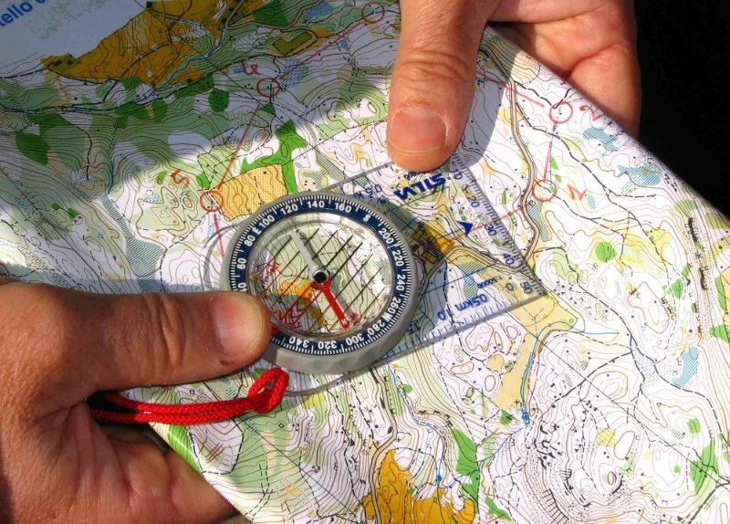
- Understanding the Basics: Compass and Map
- How to Read a Map for Land Navigation
- How to Use a Compass for Navigation
- How to Combine Your Map and Compass for Effective Navigation
- Real-Life Examples of Successful Land Navigation
Understanding the Basics: Compass and Map
Land navigation is an essential skill for anyone who enjoys outdoor activities such as hiking, camping, or backpacking. Whether you're in a dense forest, a sprawling desert, or on a mountain trail, knowing how to navigate with a map and compass is key to getting to your destination safely and efficiently.
The two main tools used for land navigation are the compass and the map. While modern technology has given us GPS devices, the traditional tools of a map and compass remain reliable, especially in areas where signal or battery life may be an issue. Together, they form the backbone of basic navigation skills that can guide you on your journey.
How to Read a Map for Land Navigation
Before you can effectively use a compass, you need to understand how to read a map. Here are the key elements of a map that you need to know:
- Scale: The scale of a map tells you the relationship between distances on the map and the actual distances on the ground. For example, a scale of 1:24,000 means that one inch on the map equals 24,000 inches in the real world.
- Topographic Features: Most navigation maps show topographic features such as hills, valleys, rivers, and other natural landmarks. These features are represented by contour lines, which indicate elevation changes. Understanding how to read these lines is essential for identifying terrain.
- Legend: The legend of a map provides explanations for the symbols used to represent various features such as roads, trails, bodies of water, and campsites. This helps you interpret the map accurately.
- Orientation: Maps are typically oriented with north at the top. Familiarizing yourself with how to align the map with the actual environment is essential for successful navigation.
How to Use a Compass for Navigation
A compass is a simple yet powerful tool that helps you orient yourself and navigate towards your destination. Here's how to use it effectively:
- Understand the Parts of a Compass: A typical compass consists of a magnetic needle that points to magnetic north, a rotating bezel (the numbered ring), and a baseplate. The bezel helps you set your direction by rotating it to align with the degrees of the compass.
- Take a Bearing: To take a bearing, first orient your compass by aligning it with the map so that the magnetic needle points towards north. Next, rotate the bezel to the desired bearing (for example, 90° for east). Then, hold the compass flat and ensure the needle is aligned with the N on the compass. This is your direction of travel.
- Use the Compass to Navigate: Once you’ve set your bearing, you can use the compass to guide you in the right direction. Keep the compass level and walk in a straight line, periodically checking to make sure the needle is pointing towards the correct direction.
How to Combine Your Map and Compass for Effective Navigation
Using a compass and map together is where the real magic happens in land navigation. Here’s how to combine them for more effective navigation:
- Align the Map with Your Surroundings: To begin, hold your map flat and place it on a flat surface. Use the compass to align the map with the terrain by turning the map until the compass needle aligns with the north lines of the map. This step is critical to ensure that the map matches the real-world surroundings.
- Find Your Location: Once your map is oriented correctly, use landmarks around you (such as trails, rivers, or mountain peaks) to locate your current position on the map. This step is crucial if you are lost or unsure of your exact location.
- Set a Course to Your Destination: Once you’ve figured out your starting point and destination on the map, use your compass to set a bearing towards your goal. Align the compass with the map’s bearing, and follow the compass direction to stay on course. Regularly recheck your position on the map to make sure you’re on track.
Real-Life Examples of Successful Land Navigation
Let’s take a look at two real-life examples where using a compass and map helped individuals navigate successfully:
1. Lost in the Forest: Emily, an avid hiker, went on a solo hike in a dense forest in California. After a few hours, she lost track of the trail. Using her map, she identified nearby landmarks, took a bearing with her compass, and navigated towards an open area where she was able to find the trail again. Her ability to use the map and compass allowed her to stay calm and regain her bearings.
2. Cross-Country Backpacking: John and his friends embarked on a multi-day backpacking trip in the Appalachian Mountains. Each day, they used their map to plan their route, then used the compass to follow their bearings through challenging terrain. By combining both tools, they were able to navigate safely and efficiently, ensuring they reached their campsite every night.
These real-life examples show how combining map and compass navigation can help you stay on course, avoid getting lost, and enjoy the outdoors with confidence. Whether you’re hiking, backpacking, or camping, knowing how to use these tools is essential for any outdoor adventure.
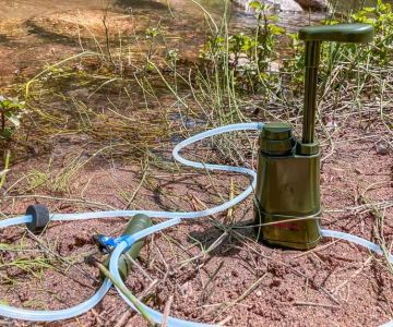
If you’re looking to enhance your land navigation skills, check out Camping Cabins for high-quality outdoor gear, including compasses, maps, and other essential navigation tools for your next adventure.


 Green Holly Campground4.0 (105 reviews)
 Campsite J400.0 (0 reviews)
 Martinak State Park, Campground, Loop A4.0 (113 reviews)
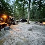 Turkey Swamp Campground4.0 (66 reviews)
 River Edge Co-Op Mobile Home2.0 (25 reviews)
 Apple Valley Village4.0 (15 reviews)
 Why Winter is the Best Time for a Camping Cabin Getaway
 Best Remote Camping Cabins for Stargazing and Night Adventures in the U.S.
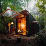 The 10 Must-Have Amenities for a Comfortable Stay in Your Camping Cabin
 Winter Camping Cabins: How to Stay Cozy and Warm in the Cold
 How to Create the Ultimate Outdoor Experience with a Camping Cabin
 Best Camping Cabins with Stunning Views of National Parks and Forests