
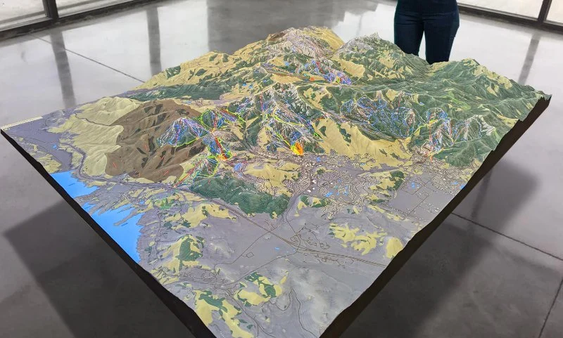
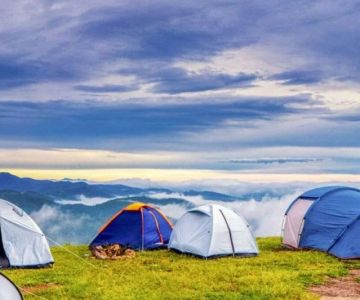
- 1. Understanding Topographic Maps
- 2. Key Symbols and Features on Topographic Maps
- 3. Reading Contours and Elevation Changes on a Map
- 4. How to Use Topographic Maps for Hiking and Finding Water
- 5. Practical Tips for Navigating with Topographic Maps
- 6. Real-Life Case Study: Using Topographic Maps in the Wild
- 7. Conclusion
1. Understanding Topographic Maps
Topographic maps are specialized maps that represent the Earth's surface features in a detailed and accurate manner, often used for outdoor activities like hiking, camping, and orienteering. Unlike simple road maps, topographic maps show both natural and man-made features with precise elevations, allowing adventurers to understand the terrain's shape, slopes, and relief. Whether you're planning a hiking trip or looking for water sources in the wilderness, learning how to read a topographic map is an essential skill for navigating safely.

Winding Brook Mobile Homes Pk
Howell TownshipMonmouth CountyNew Jersey
1081 Lakewood Farmingdale Rd, Howell Township, NJ 07731, USA
2. Key Symbols and Features on Topographic Maps
Topographic maps use a variety of symbols to convey different features of the landscape. Understanding these symbols is crucial to interpreting the map effectively:
- Contour Lines: Contour lines are the most important feature on a topographic map. They connect points of equal elevation, showing the shape of the terrain. The closer the lines are, the steeper the slope.
- Water Features: Lakes, rivers, streams, and ponds are often marked with blue lines or areas. These features can help you locate water sources while hiking.
- Trail Markings: Hiking trails are typically marked with dashed or solid lines, depending on the map. These can help you stay on track during your journey.
- Vegetation: Symbols representing different types of vegetation, such as forests or grasslands, help identify areas that may offer shelter or resources like firewood.
3. Reading Contours and Elevation Changes on a Map
Contours on a topographic map show the elevation and shape of the land. To properly interpret these lines, you need to understand how to read elevation changes:
- Contour Interval: This is the vertical distance between adjacent contour lines. The interval is usually printed on the map and is crucial to understanding the scale of elevation changes.
- Relief and Slope: A steep slope is indicated by closely spaced contour lines, while gentle slopes are shown with widely spaced lines. An area with concentric, circular contour lines often represents a hill or mountain peak.
- Identifying Valleys and Ridges: Contour lines form U or V shapes when they cross a river or stream. The point of the V indicates the direction the water is flowing, which can help you identify valleys or ridges.
4. How to Use Topographic Maps for Hiking and Finding Water
When hiking, topographic maps are invaluable for planning routes and finding water sources. Here’s how you can use them effectively:
- Identifying Water Sources: Look for blue lines or shaded areas representing rivers, streams, lakes, or ponds. These are the most reliable water sources on your map. Pay attention to the terrain's elevation to ensure you’re heading downhill to find water, as water flows naturally from higher to lower elevations.
- Planning Your Hike: Use contour lines to assess the terrain’s difficulty. Steep climbs may require additional time and energy, so plan your route accordingly. Look for flatter areas or valleys that may be easier to traverse.
- Avoiding Risky Terrain: If you see closely spaced contour lines, it indicates a steep or dangerous slope. Avoid these areas if possible or prepare for more challenging hiking conditions.
5. Practical Tips for Navigating with Topographic Maps
Effective navigation with a topographic map requires a combination of skills, tools, and knowledge:
- Use a Compass: A compass is essential for orienting your map and ensuring you are heading in the right direction. Always align the map’s north with your compass.
- Plot Your Route: Before heading out, mark key features on the map, such as water sources, trailheads, and elevation points. Having these markers will help you stay on track.
- Check the Scale: Pay attention to the scale of the map, which tells you how much ground is covered by each inch or centimeter on the map. This is crucial when estimating distances and planning time.
6. Real-Life Case Study: Using Topographic Maps in the Wild
Consider the story of Sarah, an experienced hiker who ventured into the backcountry for a multi-day hike. She used a topographic map to plan her route and identify water sources along the way. During her hike, she noticed that a stream marked on her map wasn’t flowing as expected due to a dry spell. Fortunately, she had noticed an alternative water source marked nearby. Her ability to read the map accurately allowed her to make adjustments to her route and avoid dehydration. This experience highlights the importance of understanding how to read topographic maps and adapt when conditions change.

7. Conclusion
Learning how to read a topographic map is an invaluable skill for outdoor enthusiasts. Whether you're hiking, camping, or simply exploring the wilderness, these maps provide the detailed information you need to navigate safely, find water, and understand the terrain around you. With practice, you can use topographic maps to enhance your outdoor experience and make more informed decisions during your adventures. For more tips and resources on outdoor equipment, visit Camping Cabins for the best products and services to prepare for your next hiking trip.


 East Hampton Village Manufactured Home Community4.0 (49 reviews)
 Wading Pines Camping Resort4.0 (435 reviews)
 Terry's Mobile Home Park3.0 (137 reviews)
 Delaware Seashore State Park North Campground4.0 (168 reviews)
 Marsden Tract Group Campground4.0 (38 reviews)
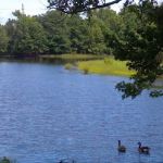 Thousand Trails Chestnut Lake4.0 (299 reviews)
 Why Winter is the Best Time for a Camping Cabin Getaway
 Best Remote Camping Cabins for Stargazing and Night Adventures in the U.S.
 The 10 Must-Have Amenities for a Comfortable Stay in Your Camping Cabin
 Winter Camping Cabins: How to Stay Cozy and Warm in the Cold
 How to Create the Ultimate Outdoor Experience with a Camping Cabin
 Best Camping Cabins with Stunning Views of National Parks and Forests