
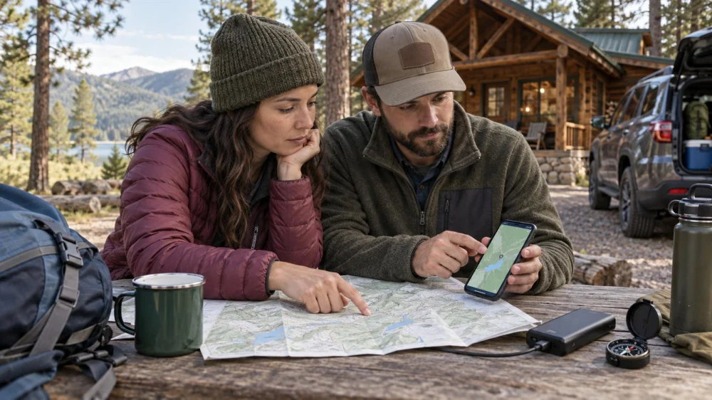
Camping Cabin Offline Maps: Routes, Pins, and Meetups
On this page
Quick answer
Before leaving reliable service, download the driving area and campground map, save the exact cabin or check-in point, and carry a current paper backup. Mark gates, parking, water, restrooms, trailheads, emergency exits, and a group meeting place. Share the route and return plan with someone outside the trip. Test airplane-mode navigation, but treat phone maps as aids—not proof that a road, bridge, or trail is open.
Cabin locations can be hard to find after dark, and a mailing address may lead only to an office or property entrance. Obtain arrival directions from the property itself.
Download more than one map
Save an offline road map covering the entire approach, including a wide margin around the destination. Also download or print the campground's own map; commercial navigation may not show internal roads, cabin numbers, seasonal gates, or one-way loops accurately.
For hikes, use a current map from the responsible land manager and learn its legend. A road map, campground diagram, and trail map serve different purposes. Check publication or revision dates when available.
Keep a paper copy in a waterproof sleeve. One phone battery, damaged screen, or corrupted download should not remove the group's only navigation reference.
Maple Glen Mobile Home Park
Jackson TownshipOcean CountyNew Jersey
46 Boxwood Dr, Jackson Township, NJ 08527, USA
Mark the places that matter
- Property entrance, check-in office, exact cabin, and assigned parking
- Locked or seasonal gates and the permitted arrival route
- Potable water, toilets, bathhouse, waste station, and shelter
- Trailheads and the correct end of each planned route
- Ranger, host, maintenance, and emergency contact locations
- Primary and alternate group meeting points
Save coordinates only as a supplement. A pin can be misplaced or route a vehicle onto a private, unmaintained, or impassable road. Pair it with written directions and visible landmarks provided by the property.
Create a group meetup plan
Choose a clear primary meeting point, such as the cabin parking area, and a backup outside any closure zone. Make sure everyone can identify both on the printed map. Set specific check-in times rather than “later.”
If the group separates, agree whether people should stay put, return by a known route, or meet at a designated place. The right choice depends on the activity and site guidance. Children and guests unfamiliar with the area need direct supervision and a simpler plan.
Give a trusted person outside the trip your property, cabin, vehicle, route, group list, and expected return time, plus instructions for what to do if you miss contact.
Prepare and test before departure
- Get current arrival directions and the property map from the host.
- Check road, gate, fire, flood, weather, and trail notices.
- Download road and activity maps with a generous geographic margin.
- Print or pack a current paper map in a waterproof sleeve.
- Mark essential facilities, contacts, and meeting points.
- Test every phone in airplane mode and open each saved map.
- Pack compatible power banks and charging cables.
- Share the route and overdue plan with an outside contact.
Limitations and emergency boundaries
Offline maps may contain outdated roads, missing hazards, or inaccurate property boundaries. GPS can be degraded by terrain, canopy, buildings, or device problems. Never cross a closure, private boundary, floodwater, snow barrier, or damaged bridge because an app draws a route through it.
If lost, injured, trapped, or threatened by weather or fire, follow local emergency guidance and contact emergency services when possible. Do not wander solely to chase a signal. Location-sharing and satellite devices have coverage, subscription, and operational limits.
Sources and evidence notes
The plan follows common outdoor-navigation principles: use current authoritative maps, carry independent backups, test tools before travel, communicate a route and overdue plan, and obey conditions observed onsite. Property managers and land agencies are the primary sources for current access and closures.
Frequently asked questions
Is a screenshot an offline map?
It is a useful backup view but may lack scale, surrounding coverage, search, and route detail. Download the full area and carry paper.
Why did the address lead to the wrong place?
A mailing address may represent an office, entrance, or parcel center. Use the property's specific arrival directions.
How wide should the downloaded area be?
Include alternate approaches and nearby communities, not just the cabin. Detours can extend beyond a narrowly saved tile.
Can I rely on live location sharing?
No. It depends on power, device function, permissions, and network or satellite availability.
What should the outside contact know?
Share names, destination, vehicle, route, planned activities, return time, and whom to contact if the group is overdue.
Conclusion and next steps
Download broad road coverage and the official property or land map, then mark the cabin, facilities, routes, and meeting points. Test the files offline and pack paper and power backups. Share a clear itinerary with someone outside the trip, and let current signs, closures, staff instructions, and real conditions override every digital line.

 Fawn Valley3.0 (4 reviews)
 HITS-on-the-Hudson RV Parking Entrance2.0 (13 reviews)
 Beachcomber Camping Resort3.0 (817 reviews)
 Adventure Bound Camping Resorts - Tall Pines3.0 (749 reviews)
 Lakeview CT4.0 (33 reviews)
 Cherry Hill Mobile Home Park3.0 (59 reviews)
 Why Winter is the Best Time for a Camping Cabin Getaway
 Best Remote Camping Cabins for Stargazing and Night Adventures in the U.S.
 The 10 Must-Have Amenities for a Comfortable Stay in Your Camping Cabin
 Winter Camping Cabins: How to Stay Cozy and Warm in the Cold
 Best Camping Cabins with Stunning Views of National Parks and Forests
 How to Create the Ultimate Outdoor Experience with a Camping Cabin